
Case studies
Real projects. Measured results.
From the seabed to construction sites, a few examples of what we capture and what our clients get from it.
Drone bathymetry from surf zone to Dead Sea
Mikhmoret · Netanya · Dead Sea · Beit Yanai
We tested a drone with a single-beam echo sounder where boats struggle: breaking waves, rocky shallows and hyper-saline water. Then we combined it with drone LiDAR into one seamless model of shore and seabed.
“The bathymetric data collected by the drone demonstrated a good match to the data surveyed by manned boat.”Prof. Dov Zviely, Ruppin Academic Center
See the result: survey lines with measured depths
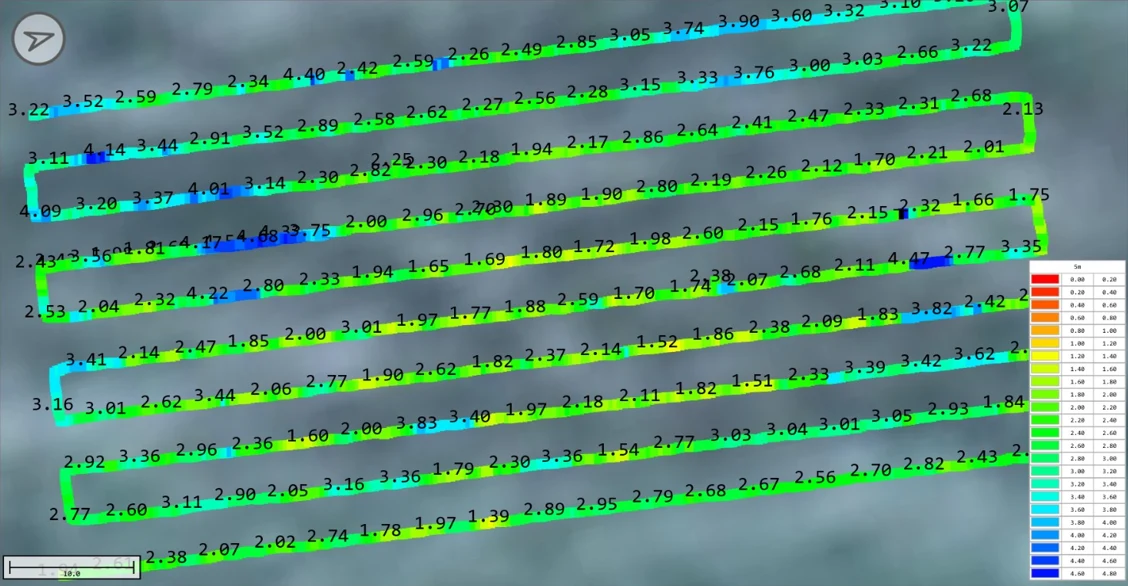 Echo sounder depths along each flight line, colour-coded by depth
Digital twin of an industrial facility under construction
Three floors and exterior
We scanned the facility with drone and laser scanner and delivered it in CYDIM: photorealistic 3D, point cloud, 360° panoramas and the IFC design laid over what was built. The project team checks progress and deviations from any location.
See the result: column deviation found in the model
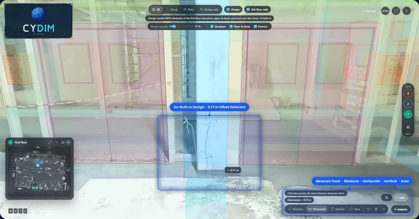 Built column vs. design position, measured directly in CYDIM
Highway corridor through rugged terrain
Sibiu – Pitești highway, Boița – Cornetu section
Together with TOPODRONE and GRAPHEIN TOPO we surveyed one of the toughest EU road projects: 7 tunnels, 24 bridges and 18 viaducts. The same drone captured the forested corridor with LiDAR, and our team operated the AQUAMAPPER echo sounder over the Olt river crossings.
See the result: Olt riverbed depth map
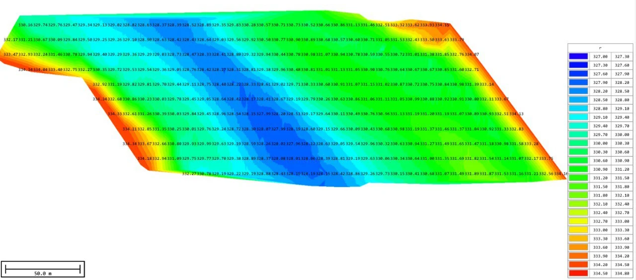 Riverbed elevations from AQUAMAPPER, merged with the LiDAR terrain model
Have a similar project?
Tell us about it and get a scope and estimate within one business day.
Request a quote